Showing posts with label Pedestrian Traffic. Show all posts

Monday, April 2, 2018

The Real Impacts of Downtown Sporting Venues

Nur Asri is an Associate at Larisa Ortiz Associates.

The 2018 Major League Baseball season is upon us. Like every other major professional sport, the season reminds us of the vast impacts– both good and bad – that sport has on our cities and downtowns. Across the country, downtowns are becoming choice sites for sports arenas. In 2016, the Brookings Institution found that 45 stadiums and arenas for the four major professional sports — football, baseball, basketball, and hockey — were constructed/renovated in the United States from 2000 to 2014 with a large majority of these being built in urban centers.

This map shows a concentration of sports teams (and by extension, their stadiums) by city from 2012.

Communities around the country are often told by political leaders of the potential economic effects of building these stadia or arenas; however the reality is often a lot less rosy. Sure, these attractions are bringing in visitors downtown in large numbers like no other business might. Last year, the average attendance to any Major League Baseball game in the US was approximately 30,000. In 2016, the Yankee Stadium in the Bronx saw over 3.5 million spectators enter their doors.

As a result, local bars and restaurants might see hikes in foot traffic due to pre- and post- game crowds seeking replenishment. In Downtown Sacramento, pedestrian traffic in the immediate area of the NBA Kings stadium grew by 10%, according to the Downtown Sacramento Partnership. Many bars have even leveraged these pedestrian counts by hosting parties that coincide with game days and even hired special DJs or introduced sport-themed menu items to lure passing crowds. Unfortunately, the same impact is unlikely for retailers offering goods and services unrelated to entertainment, dining, or sports and wellness. So the jewelry store, hair salon or local book store aren’t naturally going to be the biggest fans of a stadium.

The No-Trickle Effect
In recent years, stadiums themselves have become increasingly mixed-use and entertainment-focused attractions. This means that the developments are inward-looking and offer amenities and attractions that responsive to what already exists in adjacent areas. In particular, the retail and food and beverage offerings found within stadiums are driving visitors with busier schedules to completely skip stopping by outside bars and restaurants before games and spending their dollars directly in these arenas.

In an anecdote from 2012, owner of the Yankee Tavern in the Bronx, Joe Bastone, stated that his business was not really making more money as a result of the new Yankee Stadium’s opening. He claimed that the stadium in fact killed local business because once inside, “visitors can choose from 444 souvenir shops, eateries and concession stands, nearly 50 percent more options than in the old stadium. From hot dogs to Cuban sandwiches and sushi, and from pennants to pinstriped jerseys, Yankees fans can find it all without setting foot outside the stadium.”
Photo: USA Today
Some stadiums have carefully curated concession stands to offer local fare and structured vendor deals with local restaurants. For example, the Barclays Center in the Prospect Heights neighborhood of Brooklyn, home to the Nets basketball team and Islanders hockey team, offers Brooklyn-based Williamsburg Pizza, Café Habana Cuban sandwiches, and of course Brooklyn Lager on tap. However, stadium and sports arena developments still have much more to do in terms of growing partnership with small businesses and downtown associations and to enhance cross-shopping opportunities outside the arenas to support adjacent economies.

Furthermore, having tens of thousands of bodies arrive all at once in a concentrated geography doesn’t always bode well for businesses and residents. The hordes of spectators entering and leaving the downtown can be noisy and disorganized, and will certainly impede the regular operations of a business. To mitigate the impacts of human and vehicular congestion on game days, downtown associations are taking a few precautionary measures:

Educating potential visitors on available parking options and street closures. Partner with local news outlets to publish day-of articles that include details on how to get to sporting venues by car or by public transit. This information helps visitors plan their trip ahead of time and reduces frustration on the day of the game.
Uber at Coors Fields, CO
Partnering with ride-share services to manage people and vehicle flow near the venue. Designated Uber pick-up and drop-off areas with clear signage and instructions should be made available to riders to reduce congestion near the stadium.

Detroit Tigers, for example, signed Uber as the official ride-sharing partner for Comerica Park in downtown Detroit. The partnership not only designates pick up areas but also offers first time riders promotional codes. The same deal was made with the Detroit Lions and Detroit Pistons.

Providing shuttle rides to and from transit stops or parking lots farther away. Nashville’s Bridgestone Arena partners with the Downtown Partnership to provide such a service during event days. Again, this helps reduce congestion near the arena and makes the experience downtown less stressful for visitors.
Photo: San Francisco Bicycle Coalition

Providing convenient, attended bike parking service. This strategy has in fact made driving to games the more inconvenient option for those in San Francisco. A regulation passed by the San Francisco Board of Supervisors in 1999 requires monitored bicycle parking if an event incurs a street closure and anticipates more than 2,000 participants. As a result, all San Francisco Giants games played at AT&T park now provide valet bike parking services to more than 200 spectators, thanks to an arrangement with local bike advocacy group, SF Bicycle Coalition.

So if you’re thinking of attracting a sports team to make its home downtown in a new arena to catalyze further investment in the area and attract visitors, think also about the potential impacts it will have on foot traffic diversion and vehicular congestion. Prepare small local businesses for game days and at the same time, make sure that the arena is responsive to and supportive of existing businesses in the area. 

Tuesday, January 26, 2016

Shopping for Pedestrian Counts. CDA Compares Three Services.


When we work with clients, we are always thrilled when they have reliable pedestrian count data. This information makes it much easier for us to quickly understand what kinds of businesses an area can support, and when combined with market data, allows us to better understand the market forces that will result in thriving businesses.

Pedestrian counts (or "ped counts" for short) are perhaps one of the most valuable metrics for commercial district practitioners looking to attract quality retailers. Ped counts help us understand how people move through commercial districts and reveal actual peak hours and peak days, which can inform a variety of decisions, from business hours to the business location for different retailers.

Thanks to recent improvements in sensor technology, costs are decreasing and making pedestrian counts an increasingly attractive tool. Below is a comparison of three of the most popular suppliers in the market today, which we've summarized in a simple chart.


Motionloft is a US based data service provider specialized in pedestrian and vehicular counts. Its proprietary-owned sensor technology can track pedestrian and vehicular traffic in real-time. Sensors can be installed indoors or outdoors and require access to power and a clear line of sight. 

Reports include data summaries showing peak hours and days, and allow real interaction with the data (letting clients set parameters based on time, location, weather and direction of travel). Clients can choose between short-term (1 month) and long-term studies (1+years).  The cost per sensor for a 1 month study is $1,800 and $3,300 for a year study. The cost includes installation and calibration of the sensor(s), 24/7 access to data through the company’s online dashboard as well as reports in both pdf and excel formats.

Springboard is a British-based service provider specialized in pedestrian, vehicular and sales data. Counting devices monitor pedestrian and vehicular traffic in real-time, and are installed on buildings or lighting columns that provide access to power and a clear line of sight.

Data is delivered through reports, daily feeds and through Springboard Analyser, the company’s web-based analysis tool. Reports include data summaries showing peak hours and days, and allow some customization (based on time, location, weather and direction of travel). The cost for a 3yr study (the minimum recommended by the company) is $2,250 per sensor per year (without the cost of the 3G network, which is $600/yr). It is important to note that Springboard counters, depending on the location installed, have the capacity to track more than one intersection with the same counter. 

Eco Counter is an international provider of pedestrian and bicycles counting systems. Unlike the previous suppliers mentioned, the firm manufactures and sells counting equipment and accompanying data analysis software. The company offers two main sensors for counting pedestrians in urban environments: the Pyro Sensor and the Citix. The Pyro has two formats, the Pyro-Box or the Pyro in an urban post. The Pyro-Box Sensor comes in the form of a box that is installed at some pole or lighting column. It has the advantage that is can be moved (without the need for additional calibration). The Pyro in an urban post comes in the form of a metal short post that is affixed to the pavement. Both counters track pedestrian movement in both directions 24/7. Both Pyro models are battery operated and come with a 10-year battery life. They cost $3,500 and include installation, web-based analysis software with customization options, a public web-page for sharing the data as well as a widget that can be integrated to your district’s website.

The other model, recommended for high traffic areas, is the Citix. Citix is an overhead mounted counter that requires on-site power.  It counts pedestrian movement 24/7 in both directions, but the overhead feature makes it suitable for high traffic areas that require more precision.  Citix costs $5,000 and also includes installation, web-based analysis software with customization options, a public web-page for sharing the data as well as a widget that can be integrated to your district’s website.

How can you tell which service works best for your district? First, it depends on your traffic volume, district size and budget. Second, it also depends on your capacity to use the data strategically and ensure that the investment is worth the cost.

Motionloft is the only supplier with a short term option. Its 30-day study option can be used as a trial that allows you to test the waters and see how to use ped counts to measure overall trends in your district. This shorter option is also useful when you’re dealing with a very limited budget or when you need immediate information for a market demand update but you’re not ready for a long-term commitment. 

Springboard brings longer experience with ped count data and the counts are often part of a larger comprehensive set of services that includes retail sales and other metrics of district evaluation.  Also, Springboard sensors have the advantage of tracking more than one side of an intersection, which means that you’ll need fewer sensors for more complex and heavy trafficked areas. Larger districts with larger budgets such as Times Square Alliance and Grand Central Partnership have been using Springboard for ped counts quite successfully.  

Eco counter seems to be the most affordable option for long-term continuous counts. The cost of its cheapest sensors (the pyro) are similar to Motionloft’s 1-yr study and cheaper than Springboard’s 3-yr study. Plus, you can move them around and count different sections of your corridor without the need for recalibration. It is important to keep in mind that pyro sensors are only recommended for medium trafficked areas. Busier districts will have to get the more expensive equipment, called Citix. However, having your own sensors brings other issues, like assuming the risk of any equipment damage caused by vandalism or natural causes (hurricanes, etc.).  All things to consider...

We think that all three offer excellent service - but are different enough that the best fit will depend on your needs and capabilities. 


Friday, October 2, 2015

Measuring Impact through Pedestrian Counts

Imagine if you went through school without a getting grades or even feedback on your work? How would you know when you needed to work harder, or smarter, to do better?

In the world of Business Improvement Districts, using data to measure and demonstrate impact is becoming more important than ever. That was why I really enjoyed Gemma Noble's presentation at IDA today. Gemma is with Springboard, a leading provider of visitor/pedestrian counts. Not every BID collects ped counts, and when they do, they hire a planning or transportation firm who puts a guy with clicker on a corner. As our world becomes more automated, this is increasingly an antiquated way to measure the impact of programming, and certainly less valuable than being able to measure pedestrian traffic on a 24-hour basis.

I enjoyed seeing the different ways in which ped counts were used...some of the more interesting examples included:
  • using the data to demonstrate to city officials that high ped counts during a major holiday warranted additional security. 
  • using the data to determine whether an event was successful or not - because you have the counts to prove it!
  • being able to measure the impact - before and after - of significant public realm improvements
  • being able to compare pedestrian counts against the sale of retailers in your district - and demonstrate to businesses the fact that your events and activities are directly correlated to their sales
Being able to tell the world you are doing a good job reinforces the value of your BID, supports your request for additional resources to make more impact, and helps build employee morale and motivation. A win-win for all.


Friday, August 7, 2015

Roundup: Best Practices for Generating Pedestrian Activity, Cons of Mixed Use, Detroit's Two-wheel Culture, Abandonment of Suburban Office Parks, and Chicago's Riverwalk

Which Streetscape Features Best Generate Pedestrian Activity?
An academic publication by Reid Ewing et al, examined which features and elements most effectively encourage pedestrian activity. They found that three of twenty features had a significant impact on ped counts: the proportion of windows on the street, the proportion of active street frontage, and the number of pieces of street furniture.  Fascinating and good news for districts who want to know what kinds of street furniture they should invest in!  Direct link to publication here (accessible through Aug 31).

Big City Dreaming: The Sometimes Mixed Results of Mixed Use
As the pendulum has swung away from Euclidian zoning toward mixed use, there are some hazards that practitioners should be aware of. For example, too much vacant retail has become the unintended blight of mixed use in smaller urban/suburban areas - "too many cities are insisting on mixed uses in locations that are, at best, suitable for a single use."

Detroit Bike Culture Is Unstoppable
Two wheels are starting to dominate the scene in the city known for four wheels.  Despite the city dealing with bankruptcy and blight, the Motor City of Detroit continues to see a renaissance that expands year after year.  A weekly bike meetup, the Slow Roll, now has thousands of riders. The bike lane network will expand to 200 miles. The annual Tour de Troit will have an estimated 7,500 riders this fall. And new bike oriented businesses are sprouting up.

Suburban corporate campuses came on the American scene in the 1940's outside of Birmingham and spread thereafter, but have reached a tipping point especially in the suburbs of Washington DC where it is reported that there is enough vacant office square footage to fill the Mall of America four times over and fill most of the Pentagon. See what and why...

Chicago continues its reputation as an architectural magnate with the addition of new public spaces on the Riverwalk. Chicago has tried before to create public space along the Riverwalk, this time however, with wonderful conceptualization, craftsmanship, design, and detailing, appears to be a public space that will connect the public to the water effortlessly for a long time to come.


Friday, June 26, 2015

Gil Penalosa inspires a discussion about communities that meet the needs of everyone from age 8 to age 80.

Making communities safe and welcoming to all people regardless of age, income, race or ethnicity was the topic of a panel I moderated at the ICSC Midwest Urban Forum in Detroit this past week. One panelist came from slightly further afield. Urban planner Gil Peñalosa, former Parks Commissioner for the City of Bogota, Colombia (where his brother Enrique served as Bogota's Mayor) offered a compelling vision and rationale for communities to meet the needs of people from the ages of 8 to 80 - which is why he founded a non-profit based out of Toronto called 8-80 Cities.
Gil Penalosa, former City of Bogota Parks Commissioner speaking at the IDA Midwest Urban Forum in Downtown Detroit. If you are wondering about the empty chairs in the background...it started raining and we improved beautifully by bringing everybody onto the stage with us! 
He succeeded in painting one of the more compelling visions of a walkable downtown that I've heard in a long time. He started by asking the audience to imagine an 8-year old child that they love. Then he asked them to imagine an 80-year old senior that they love. He finished by asking "would you feel comfortable with that person walking or crossing the street in your neighborhood? Would you send them along to the nearest store to grab a pint of milk and eggs?" By putting walkability and safety in these very personal and blunt terms, he said more in just a few sentences than most people can say with charts and graphs in a half hour. 

This challenge, making communities realize the importance of connectivity, walk-ability and bike-ability to local commercial districts, has been coming up for us more and more here at LOA, particularly when we deal with neighborhood commercial districts that are struggling to remain relevant as shopping destinations. When you talk to business and property owners in many of these districts - our most recent project in a small NJ town comes to mind - they complain about lack of parking. Yet in this case, the district is surrounded by fairly well off walkable neighborhoods. Unfortunately, over time the safe walkable/bikable connections between the commercial district and the neighborhood they serve have been eviscerated. Roads widened and sidewalks narrowed to accommodate vehicles moving at faster and faster speeds. So the impact of road expansion is two fold. Not only are cars encouraged to speed, but when people consider going to their local commercial district, they hop in their cars. And once they are in their cars, a few extra minutes takes them someplace with more parking, more retail offerings and more selection. In this environment, traditional commercial corridors struggle to compete. 

So what are the elements of a successful walkable, bikeable commercial district? Here are a few:
  • Bike parking. Adequate,convenient places to safely park your bike. 
  • DO: Consider setting aside adequate parking for bikes.
    One parking space can fit up to 12 bikes.
  • Bike lanes. This is not just about bike lanes on the commercial street, it is also about outfitting connecting streets with bike lanes that offer safe and convenient access to the district from nearby neighborhoods. 
DO: Do your best to create safe, dedicated bike lanes.
In Long Island City, Queens the dedicated two-way bike paths
offer cyclists safety at a very busy intersection. 
  • Sidewalks wide enough, safe enough, and comfortable enough for an 8 year old, or an 80 year old, to walk on.
DO: Even streets without trees can be comfortable for pedestrians.
In Great Barrington, MA awning provide much welcome shade during hot days. 
  • Slow(er) moving vehicles. Consider traffic calming measures that prioritize pedestrians at crossings. 
    DO: Bump-outs are a way to give your road a diet...
    and narrow streets are a great way to slow down cars. 
  • Pedestrian lighting. The traditional cobra head light does a great job of lighting streets at night, but what about sidewalks? Pedestrian lighting is scaled to offer light for those who use sidewalks. 
    DO: Pedestrian lighting is for pedestrians. Cobra heads are for cars. 
  • Benches. Offer a reprieve for seniors and when placed in front of stores, are more likely to be monitored. 
    DO: Find out if your businesses can set out benches in front of their stores.
    If the regulatory powers that be allow it, it can be a great way to offer kids and elderly much needed reprieve between visits to stores. 


Friday, December 5, 2014

Some Roads Should Just Go on a Diet

Bigger is better right? By and large the answer is no. Bigger is not always better when addressing roadways that run through commercial corridors.  In many places where LOA works, the challenges of a too wide street - one designed for cars but not for people or even bikes - undermines local businesses who see traffic speed by, unlikely to stop.

The problem of too wide streets is rampant throughout the nation. This issue came up recently for us...LOA is currently working on a project in Chicago where the large berth of the street was simply too cumbersome and unnecessary. And when we looked at traffic counts we found that there was actually much less traffic on a road that was clearly designed to handle much more. So, what to do with so much excess "fat"?  We suggested that roadway go on a road diet.

“Road dieting” is a term applied to “skinny-ing up” streets into leaner, more productive members of society. The ideal roadway candidate, as Burden and Lagerwey, of Walkable Communities Inc, note in "Road Diets: Losing width and gaining respect," is often a four-lane road carrying 12,000-18,000 auto trips per day. But as many of you know, road diets can be controversial in places where people think that a narrower road means more congestion - but in most cases the facts simply do not bear out.

Before and after Road Diet pictures. Image source:
safety.fhwa.dot.gov/newsletter/safetycompass/2012/winter/
Before we get to that, first back to Chicago. Our work resulted in a few key recommendations, the first included removal of a dedicated rush-hour lane (a parking lane that was converted to a travel lane only during rush hour - making it impossible for drop-in customers to stop by and therefore hurting local businesses). What we found that that although the street was perceived as a busy thoroughfare, data suggested otherwise: 13,300 Annual Average Daily Traffic (AADT) counts (between North Pulaski Road and North Kedzie Avenue) put the traffic flow as moderate to relatively low.

With low-traffic counts, we knew that the replacement of a single rush hour lane with on-street parking would not only allow customers to stop more easily - picking up food or convenience items on their way to or from work - but that it would also result would be slower speeds for motorists in general. Narrowing the flow of traffic and adding bike lanes – aka a “road diet” - would help address some of the concerns that residents and businesses have with the sometime excessive speed of motorists who pass through the area. And taking this a step further by adding a lane for bicyclists would add another transportation option  for a low-income community with very low car ownership rates.

Much safer corridor for all. Image source:
domz60.wordpress.com/2014/08/26/road-diet-bibliography/
Public safety has always been a proponent of change for urban development and planning, this case is no different. A reduction in a lane or lanes, a road diet, can reduce unsafe driving, excess speeds, and serve as a street calming mechanism. Burden and Lagerwey note "crash rates and severity of conflicts with autos result in almost certain death (83% of pedestrians hit at 40 mph die)".  Four lanes of traffic are difficult to cross for pedestrians and uncomfortable/dangerous for cyclists. Furthermore, businesses that might benefit from co-location across the street from another business never accrue the benefits because for most pedestrians, they might as well be miles away.

In addition to safety, a road that has dieted sees change in commercial activity around the road. The change can increase value of existing properties and some cases costs of reconstructing roadways are repaid in as little as one year through increased sales tax or property tax revenue.

Image source: sf.streetsblog.org/category/
san-francisco-neighborhoods/district-6/
Even high-density urban downtowns can go on diets. San Francisco, as seen in the image to the left, envisioned a downtown along Sixth Street with a more pedestrian and cycling friendly environment with continued on street parking.

In an opposite regard, a study by Thomas Welch “The Conversion of Four-Lane Undivided Urban Roadways to Three-Lane Facilities” demonstrates the problems and negative outcomes associated with increasing road sizes from a slimmer two-lane road to a wider four-lane road.  Welch notes it led to increased accidents, increased speeds, increased corridor delays, and increased injuries.  Not the results people want or expect - sometimes slimming down is the best remedy for the health of your commercial district.

If you want to read more...here are some additional readings:

Tuesday, October 21, 2014

Best Practices in City-led “Parklet” Efforts

Parklets are a growing strategy that commercial district managers are using to drive traffic to their local business districts, and with good reason.  According to the 2011 San Francisco Great Streets “Parklet Impact Study,” foot traffic increased 44% in a studied area, those stopping to engage in stationary activity tripled at another, and business owners denied any decrease in business while some reported an increase.

The term “parklet” was first used in San Francisco to describe a parking spot turned mini-park and originated from the 2009 San Francisco Park(ing) Day.  A typical parklet includes a platform on pavement adjacent to a sidewalk. Many parklets include additional seating, landscape, and tables.  Parklets have now spread to many other cities, including New York, Los Angeles, Chicago, Oakland, Philadelphia, and Long Beach. (Source: Grand Rapids Parklet Manual)

Many other cities have caught on to the appeal of parklets and have begun parklet pilot programs.  Cities on the list include Seattle, Minneapolis, Miami, and Grand Rapids.

Parklets are a creative solution to the desire for wider sidewalks especially in areas with narrow sidewalks or a lack of open space.  Although parklets are not permitted to engage in direct commerce like sidewalk cafes or table-side service, a 2010 Divisidero Trial Parklet Impact Report noted they do increase foot traffic (13-37% according to the study), economic activity, bike parking, and public relaxation and socialization. http://nacto.org/docs/usdg/divisadero_trial_parklet_impact_report_pratt.pdf

Pilot programs vary from city to city, but there has been an uptick of activity. A few programs that we like here at the Commercial District Advisor include the following:
With many benefits and few disadvantages, withstanding the loss of one or two parking spots, parklets demonstrate the growing impetus to leave the car and gather with your community to laugh, love, relax, and to have a shared experience. 


Photo by: San Francisco Planning Department
Lessons Learned
It appears that parklets have common themes.  They generally take up one to two parking spots, have seating and landscaping, and the overall responsibility lies on the “host” to maintain.  What other lessons are there to be learned moving forward with parklets:
  • Are there some places that shouldn’t do parklets? Raleigh completed a Parklet Feasability Study and noted specific locations within their city that parklets shouldn’t be.  One could induce from their results that parklets should not occur in areas with low pedestrian destination traffic, in places with sufficient plaza or open space already, high parking demand, busy or dangerous streets or streets that need reconfiguring, and streets entering residential neighborhoods. (http://www.raleighnc.gov/content/extra/Books/PlanDev/ParkletFeasibilityStudy/index.html#/30-31/zoomed, 2013)
  • Do we need to ensure that someone manages them? It is important for parklets to keep up appearances, after all the purpose is to ensure a little bit of green space for public enjoyment.  The common rule is to hold “hosts” responsible for maintenance and appearance.  Most parklet programs have parameters and specific guidelines in place for hosts to maintain their parklets.
  • Are they best when connected to a local business?  More studies are needed to gauge specific metrics of whether positive effects come from parklets adjacent to businesses.  All parklet programs prohibit direct service to businesses such as table-side service or cafĂ© service.  Nearly every city requires parklets to be open to public use, but Long Beach, CA allows discretion on the owner whether they require patrons to make purchases (http://www.raleighnc.gov/content/extra/Books/PlanDev/ParkletFeasibilityStudy/index.html#/4-5/, 2013).
  • What about the homeless?  Like most urban public plazas and parks, parklets will also have the issue of how to regulate or manage the homeless if their use of the parklet is outside of the intended purpose.   San Francisco has shut down at least one parklet because it had become a prime destination for drinking and carousing (http://www.berkeleyside.com/2013/07/08/berkeley-parklets-stir-up-excitement-apprehension/, 2013).
Image via http://www.minneapolismn.gov/
Additional Resources

Tuesday, July 8, 2014

Create Vibrant Nighttime Destinations with Evening Markets

The setting sun throws a golden light on the street as people wander from vendor to vendor, sipping wine, trying new foods and purchasing goods from local merchants. This market will continue well into the the night and include musical entertainment, arts displays and even more food.

The night market, an age old tradition in South East Asian countries where dark nights provided relief from the excessive heat of daytime, are gaining popularity throughout the United States. Traditionally focused around food, the night market offers people a place to gather, eat, drink, and interact without being confined to a bar. Night markets also take advantage of the urban environment, often happening on streets and sidewalks, as well as plazas and vacant lots. They can help add life to areas of town that are either generally less busy, or those that see a sharp decline in street traffic after business hours.

626 Night Market Image source: laweekly.com
Los Angeles, Philadelphia and Nashville are all home to successful night markets. In LA, the 626 Night Market started in 2012 in Pasadena,  has since moved its main location to the San Anita Racetrack expanded to include two more sites in Costa Mesa and downtown LA. The 626 Night Market was modeled after those in Tawian, where creator Jonny Hwang was born. As quoted in KCNETLink article, Hwang sees the markets as a place for community and a place to bring cultures together.


Nightmarket Philadelphia Image source: Philly Homegrown
In Philadelphia, the Food Trust's Nightmarket Philadelphia serves other purposes. Created by the Food Trust non-profit, an organization who's mission is to ensure that everyone has access to affordable, nutritious food and information to make healthy decisions, the night market travels from neighborhood to neighborhood throughout the city. According to PA Senator Bob Casey the night market has helped reinvigorate Philadelphia's neighborhoods while providing jobs to hundreds of local residents.

Image source: Nashville Farmer's Market Facebook
On the third Friday of every month the Nashville Farmers' Market hosts a nighttime event that includes restaurants, farmers, arts, crafts and more for visitors to explore. The events usually have live musical entertainment as well as vendors both housed in and visiting the market. Different from other night markets, the Nashville Farmers' Market has a permanent location that includes a farm and sheds, market house, kitchen and flea market area that is open 362 days a year, rain or shine.


Night markets create a new and exciting environment for residents and visitors to interact while sampling a city's local food and merchandise, they can help create strong sense of place and energize a sleepy or worn down neighborhood by bringing a vibrant event to city streets.

Melanie Truhn is a full time graduate student in Pratt Institute's City and Regional Master's Program. When she's not biking around Brooklyn she can found in Prospect Park with her pups.

Friday, February 21, 2014

Round Up: Low Cost, High Impact Tools to Address Common Issues

You don't need a big budget to make a noticeable impact in your commercial district. Here are a few tools that are easy and inexpensive to buy/download/DIY that help to address common problems.

The problem: There's a vacant storefront or lot that has become an eyesore OR You want to solicit community input for a new development, or retail attraction program, but aren't sure how.

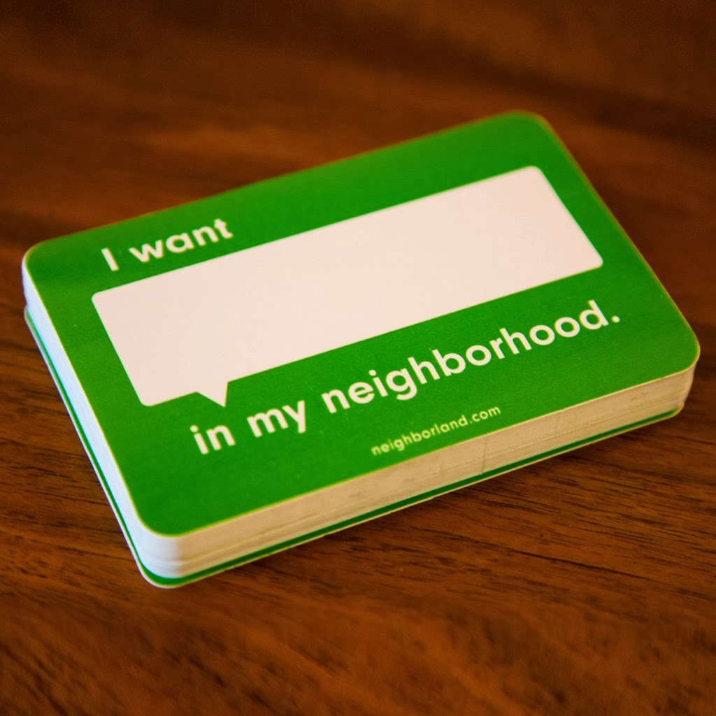
The solutionNeighborland's "I want _ in my neighborhood" stickers, or templates for mobile whiteboards to collect input in public space. Buy the stickers from their website ($0.35/each) and team up with the owner of a vacant site. It will draw attention to the space (a plus for the owner) and give you/potential retailers a sense of what people in the neighborhood want.


The problem: You have so many great attractions and amenities in your district, but not everyone knows about them, or how to get from one to the next.

The solution: Walk Your City's Sign Builder lets you design your own wayfinding system to make your community more walkable, and help visitors get from place to place. Using their online system - you design it, they print it, you install it.


The problem: You have empty tree pits, a vacant lot, or other spaces that could use a little greening.

The solution:Guerrilla Gardening.org shows you where to buy and how to make your own seed bombs to green your district or beautify vacant sites.


The problem: You've got some underutilized spaces that could be great - if only people had a reason to be in them.

The solution: Red Swing Project hangs swings in public spaces to "inspire playfulness" around the world. Download the free how-to manual on the website to make your own swing.

The problem: You want to do so many fun projects and you don't know where to start.
The solution: Betterblock.org has information on projects that communities are doing all over the country - from temporary bike lanes to pop-up stores, as well as a series of questions to help focus your efforts when planning how you are going to make a better block.


Author Kristen Wilke is a Project Manager at Larisa Ortiz Associates.

Wednesday, June 19, 2013

Does Bike Infrastructure Help Local Businesses?

Bicyclists on Valencia Street in
San Francisco are a common sight
With the inaugural run of NYC CitiBike well underway, Nicole Leighton, LOA's newest staff member, takes a look at how bike lanes and other bike infrastructure can help drive retail sales for local businesses. 

By Nicole Leighton

I recently returned from a trip back to my home city of San Francisco. While I’m there I typically bike much, much more than I do in New York. I bike almost daily to do errands, go shopping, and meet up with friends or family. While much of this difference can be attributed to New York’s comprehensive subway and bus system that usually makes it the most convenient choice, another main reason I love biking so much is San Francisco's welcoming bicycling environment. The City offers cyclists the infrastructure and the culture that make cycling fun, easy and convenient. While NYC has been adding tons of great improvements to its bicycle infrastructure, the culture has some catching up to do with SF.
Having worked at LOA for many months now, I couldn't help but apply a retail lens to my cycling habits. Every time I ride my bike somewhere, I end up spending money—sometimes planned, often not. Sometimes I ride my bike to go grocery shopping, while other times I’ll just take my bike out to enjoy the weather, and end up stopping at a store with inviting window displays. I knew I knew I couldn't be the only one who does this, and found a few studies that reinforce the linkages between cycling and spending habits.

One study in 2003 surveyed 27 businesses randomly chosen along Valencia Street in San Francisco, a corridor that I often frequent. After bike lanes had been added to the street, 37.0% of respondents said sales were better and none said sales were worse. Of respondents, 55.6% reported a positive effect on area residents shopping locally, and 44.4% reported an increase in new customers coming from outside the neighborhood. A similar study was released more recently by NYC DOT, which studied the effect of the protected bike lanes on local businesses in the Chelsea neighborhood. The study reported an up to 49% increase in retail sales for locally-based businesses on 9th Avenue from 23rd to 31st Streets--compared to a borough-wide average of 3% for the same period!

Anecdotally, I know that walking or biking by stores makes people much more likely to shop on a whim than when in a car (or on the train). Especially with the launch of the bike share system here in NYC, it will be increasingly important for commercial corridors to consider all modes of transportation and users of the street when creating an inviting shopping environment, including cyclists. This doesn’t only mean bike lanes, it can also include smaller amenities like bike racks or perks like discounts to customers with helmets. (Tip: anyone can suggest a location for NYC DOT to add a free bike rack here.) With the launch of Citi Bike, I’m really hopeful that an increase in bikes on the road will create a more prevalent and welcoming biking experience here in my second home city.

Sources:

  • Emily Drennen, 2003. “Economic Effects of Traffic Calming on Urban Small Businesses,” Department of Public Administration, San Francisco State University.
  • NYC DOT, 2012. “Measuring the Street: New Metrics for 21st Century Streets”

Nicole Leighton is a recent graduate of Barnard College with a degree in Urban Studies. She has been with LOA since Sept. of 2012 and currently serves as a Summer Associate.

Friday, January 25, 2013

Changing the World, One Step at a Time


What does it take to create community change?

People are threatened by change and will often resist new ideas, even good ones, if they are unsure of the outcome. Leading change means taking risks - but those risks don't need to be done all in one shot, in fact, it can sometimes be helpful to run experiments and test new concepts to start getting folks more comfortable with your new ideas. But keep in mind that testing means that sometimes things succeed...other times they fail. So one thing is for sure, you can't be afraid of failure...it can happen.

An aerial view of Putnam Triangle, in Brooklyn, NY
What does testing a concept look like in practice? A wonderful example of community change is the story of Putnam Plaza, a segment of street in Clinton Hill, Brooklyn that I've written about before. (see: "BID's efforts pay off for residents, businesses with street closure and block party"). Closing a street is no easy task, as Phil Kellog, Executive Director of the Fulton Area Business Alliance, and a Coro Neighborhood Leadership Alum, came to find out. Business owners are often concerned that a street closure will hurt business. The answer? A temporary closure that would allow the BID to test the concept. The street closure was coupled with programming, led by the BID, that drew pedestrian traffic to the area. Local business owners were pleasantly surprised by the increase in sales they experienced, and surprise, surprise they eventually came on board. Just this month the Department of Transportation approved the permanent closure of the Plaza. (see: DOT Approves a Permanent Putnam Triangle Plaza). Success!


Wednesday, October 19, 2011

BID's efforts pay off for residents, businesses with street closure and block party

The energy and excitement captured by this video tell the story of Putnam Plaza, a segment of street in Clinton Hill, Brooklyn that was recently closed to traffic. Its new life as a public plaza was celebrated with a block party that had people, literally, dancing in the streets. Local cafes and convenience stores did a brisk business as well.

This event was a true community affair, led by the the Fulton Area Business Alliance (a Business Improvement District), which sponsored the plaza. Phil Kellog, a Coro Neighborhood Leadership alum, shared his project with us at our final session where every participant shared the story of a project that they had worked on throughout the course of the program. Phil managed all coordination with city agencies necessary to make this project a reality. The plaza is yet another reason why BID's are an excellent community investment. 

Here's a great feel good video by a local filmmaker that captures the excitement and makes ya wanna dance!

Monday, September 26, 2011

Managing Mix: Redefining the Downtown Anchor

In the retail industry, the word anchor is often narrowly defined. For many, an anchor store is a big box tacked on to a mall, filled with general merchandise and the words "Macy's" on the side. Downtown anchors, on the other hand, are much more diverse and eclectic, and include a slew of uses and activities that may be nontraditional in a typical shopping center, but are just right for the traditional downtown and neighborhood commercial districts.

As you consider ways to drive retail traffic to your downtown - anchors are a critical piece of the puzzle. Like a mall developer, downtown anchors define the downtown brand, so attracting an anchor, or helping to grow an anchor, inevitably becomes part of your district's strategic positioning.  But I encourage you to take a moment to define anchor more broadly. If you do, you'll begin to understand the variety of ways in which other uses play a role in driving pedestrian traffic to all of the businesses in your district.

I have found that the Urban Land Institute offers a categorization of anchors for retail entertainment destinations that is also applicable to the downtown context:

Activity generators - Traditional theatres, movie theatres, cultural and educational facilities and institutions - these are all anchors that generate activity. Visitors come to your neighborhood specifically to visit these locales. The more unique and interesting the offerings, the further people will travel to experience what your community has to offer. A great library can be a wonderful activity generator. I worked in one community where the library held daily events that drew thousands of visitors a week, both during the day and in the evening. These visitors often left the library looking for a quick bite to eat, and local coffee shops and delis were more than happy to oblige. Under the best of circumstances, activity generators support the growth of complimentary retail in the immediate vicinity (i.e. walking distance) of the activity generator that cater to the same customer. As you think about retail mix in your district, identify these activity generators and think about the kind of retail and services that would compliment the use. Engage your anchor institutions in a conversation about what goods and services they would like to see around them and use this to inform your retail leasing strategies.

Activity extenders - These activities are typically complimentary goods and services that give visitors more of a reason to stay in your district, beyond their original destination. These uses typically include restaurants and eating establishments. Nothing keeps people an extra hour than a tempting place to eat or grab a cup of coffee. I also like to make the argument that public restrooms are an important and sometimes overlooked activity extender as well. If there are no restrooms available when nature calls, a trip or visit to a store will be cut short, perhaps indefinitely. When I was pregnant I distinctly remember being pleasantly surprised that the apparel store Motherhood Maternity had a ladies room on site. "Of course!", I remember thinking, they want to keep you here as long as possible! Bookstores always have restrooms for the same reason. They know that the second you leave the store, they have lost you as a customer.

Activity inducers - These are those niche and speciality retailers that are destinations in their own right. In New York, these include unique apparel of speciality food stores (Trader Joe's comes to mind). FAO Schwartz on 5th Avenue. In my Queens neighborhood, the well-known Indian grocery store Patel Brothers serves this function as well. Great commercial districts have at least a few of these activity inducers that in some cases have become synonyms with the district. If you have one of these retailers - be sure to support their efforts to market and promote themselves.

These are but a few examples of nontraditional anchors...